 MAVUNO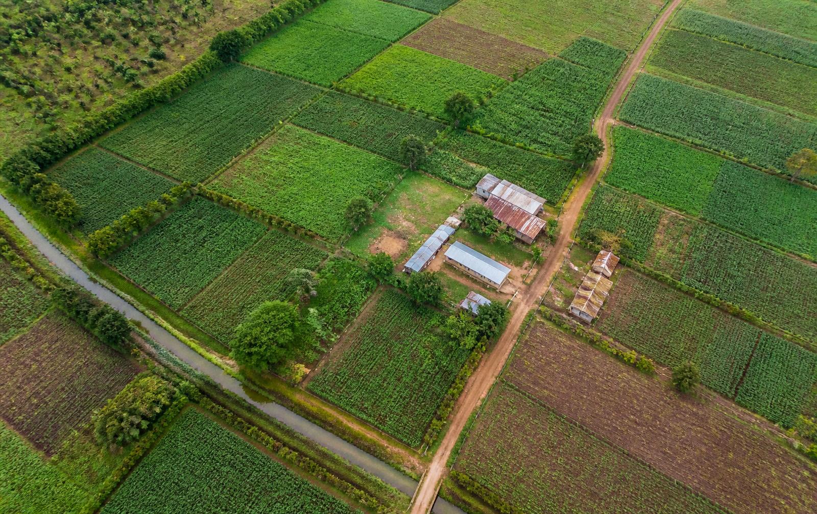
Agribusiness
Understand farms, production areas, suppliers, growing conditions and access to markets.
Satellite evidence for agribusiness finance in Kenya
Agribusiness lending and investment in Kenya depends on questions paperwork cannot settle. A credit file shows invoices and accounts. It does not show whether the land in Kiambu, Nakuru, Meru or Trans Nzoia was actually being farmed over the last few seasons. Mavuno builds that missing picture from free satellite and rainfall information, and delivers it as an Evidence Pack you can read in minutes.
Each pack answers one question with dated observations: how much of the stated area shows active farming, how the last few growing seasons looked, and how rainfall compares with a normal year. Every finding says where it came from, when it was taken, which area it covers, how we worked it out, how confident we are and what it cannot show.
The point is practical: make the place behind a business case visible. Mavuno does not score borrowers, replace your own checks or make lending decisions. It gives credit officers, analysts and programme teams a clear basis for what to check on the ground next.
An agribusiness case usually rests on things you cannot see from an office: a farm in a particular place, land actually under production, a season that supports the volumes promised, and suppliers close enough to be practical.
Accounts and invoices cannot show any of that. Site visits are costly, rare and show one day only.
Questions we hear
- Is the farm where the business says it is?
- How much of the stated area actually looks like it is being farmed?
- What have the last few growing seasons looked like?
- Where are the suppliers, and how far are they from the processing point?
- Do the production figures in the plan look realistic for this place?
- What should be checked on the ground before deciding?
What we can show
What Mavuno adds to the question.
Drawn from free public satellite and rainfall information, plus whatever the business chooses to share with us.
- What is growing
- Satellite pictures show how much of the site and the land around it is under active cultivation.
- The seasons
- Several seasons of images show the growing rhythm of the place.
- Rainfall
- How much rain has fallen, and whether that is normal for the area.
- Site and boundaries
- We compare the boundaries you give us against what the land actually looks like.
- Suppliers and distance
- How far suppliers, roads and markets are from the site.
How it runs
From your question to your answer.
- 01Ask: agree the financing or commercial question with you.
- 02Locate: agree the place — the site, the farm blocks or the supply area.
- 03Understand: bring together satellite images, rainfall records and anything the business shares.
- 04Explain: write up what we found, how confident we are and what it cannot show.
- 05Decide: you receive the pack, with the ground checks that should follow.
Example
What a pack might answer.
Business question
Is the vegetation and seasonal context around this declared production block consistent with the volumes in the business plan?
Declared production block and 5 km surrounding context, Kiambu County, Kenya
What the pack would show
- Vegetation index summary across the declared block
- Season-by-season index profile over recent cycles
- Rainfall accumulation and anomaly context
- Proportion of the declared area showing a cultivated signal
What you gain from it
A reviewer can see whether the observed land signal is broadly consistent with the declared operation, where it diverges, and which parts of the claim still require ground verification.
Limitations
- This example is illustrative. It is not an assessment of any real business.
- Satellite information shows physical conditions, not commercial facts.
- Every real pack states its own limits, for its own place.
Common questions
Asked before a pilot.
- Can satellite data confirm that a farm exists where a borrower says it does?
- Satellite pictures can show whether the stated location looks like farmland being worked, and how that has changed over recent seasons. They cannot confirm ownership, tenure or who farms it, so every pack says which parts still need a site visit.
- Which satellite sources does Mavuno use for agribusiness work?
- Free Sentinel-2 and Landsat 8/9 satellite pictures, CHIRPS rainfall records and, where cloud is a problem, Sentinel-1 radar — plus whatever the business shares with us.
- How is this different from a farm management or yield prediction tool?
- Mavuno is built for the person making a decision about the business, not for running the farm day to day. You get evidence for a financing or commercial decision, with its limits stated, rather than an operating forecast.
Where it is used
Who uses this evidence.
- Credit files for agricultural lending
- Investment memos and pre-screening
- Insurance risk review inputs
- Portfolio-level agricultural exposure reviews
- Buyer and offtaker supply assessments
Have a business question that depends on place?
Tell us the question and the place it concerns. We will say whether Mavuno can add useful evidence to it, and what it would not settle.