 MAVUNO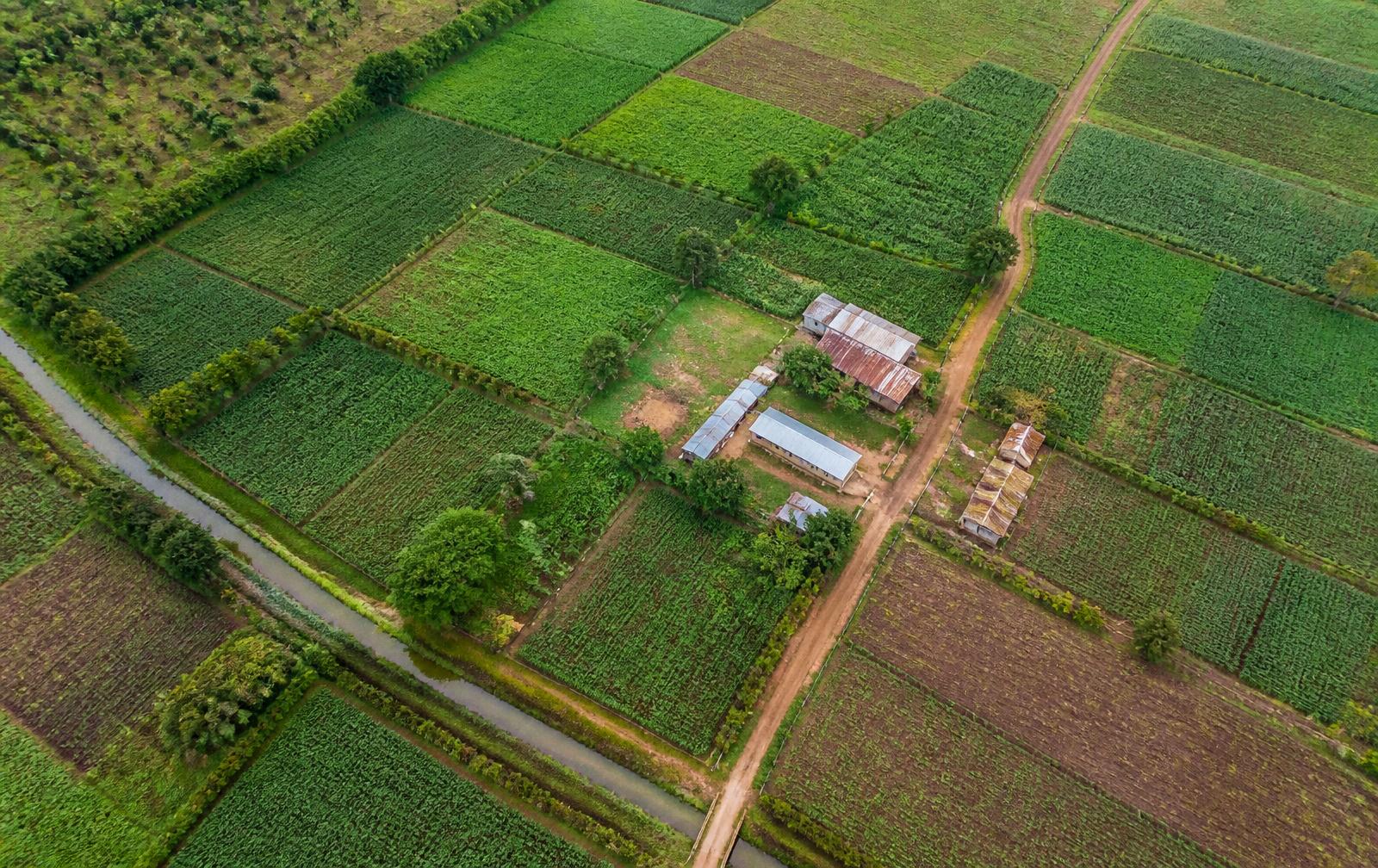
Cold Chain
Understand where products come from, where they need to go, and how routes, facilities and supply areas connect.
Cold chain investment evidence for Kenya and East Africa
Cold rooms, collection hubs and pack houses are financed on assumptions about the produce around them: what is grown nearby, how far suppliers are from the door, and how the seasons affect throughput. Those assumptions usually arrive as a paragraph in a business plan. Mavuno turns them into dated observations.
An Evidence Pack for a cold chain asset shows the supply area within a stated distance, the route between collection points and the facility, and the rainfall and seasonal conditions around it. You see how suppliers, roads and markets connect, and how farming activity nearby changes through the year.
For lenders, investors and programmes reducing post-harvest losses in Kenya, this is the difference between a claimed supply area and one you can see. We report what the information supports and flag what it does not: pictures show physical conditions, not committed volumes or commercial relationships.
A cold room or pack house only works if enough produce exists close enough to reach it, and if the roads to market behave the way the plan assumes.
The building does not move. The case for it is only as strong as the supply area around it.
Questions we hear
- How much production sits within collecting distance?
- How do collection points, the facility and markets connect?
- When is supply available through the year?
- Where along the route might weather or access cause problems?
- Is the facility being built where the supply actually is?
- What should be confirmed with operators before spending money?
What we can show
What Mavuno adds to the question.
Drawn from free public satellite and rainfall information, plus whatever the business chooses to share with us.
- The supply area
- What is growing across the area the facility would collect from.
- Routes and connections
- How collection points, the facility and markets connect to each other.
- When supply peaks
- When production around the facility is likely to be at its highest.
- Rainfall
- Rainfall patterns that affect harvest timing and road access.
How it runs
From your question to your answer.
- 01Ask: agree the throughput or siting question.
- 02Locate: set the facility point, the collection area and the route to market.
- 03Understand: look at production, seasons and rainfall across the supply area.
- 04Explain: show where supply sits, when it peaks and how confident we are.
- 05Decide: you receive the pack, with what to confirm with operators.
Example
What a pack might answer.
Business question
What is the recent rainfall and vegetation context surrounding this proposed cold-chain supply basin?
Proposed facility point and 25 km collection catchment, Turkana County, Kenya
What the pack would show
- Vegetation index distribution across the collection catchment
- Rainfall accumulation relative to the recent multi-year pattern
- Spatial concentration of productive land within the catchment
- Distance profile between aggregation points and the facility
What you gain from it
An investment committee can see where the supply base is concentrated, when it is likely to be available, and which throughput assumptions still need operator confirmation.
Limitations
- This example is illustrative. It is not an assessment of any real business.
- Satellite information shows physical conditions, not commercial facts.
- Every real pack states its own limits, for its own place.
Common questions
Asked before a pilot.
- Can Mavuno verify the produce volume feeding a cold room?
- No. Satellite information shows farming activity around the facility and how far the collection points are. Volume is a commercial fact that has to come from records and ground checks.
- What does a cold chain Evidence Pack contain?
- One question, one defined area, dated observations of the supply area and route, rainfall and seasonal context, a plain explanation of what it means, how confident we are, what it cannot tell you and what to check next.
- Does this work outside Kenya?
- Yes. We use free global satellite and rainfall records, so the same approach works across East Africa wherever the area can be defined and cloud does not hide it.
Where it is used
Who uses this evidence.
- Asset finance and equipment lending reviews
- Blended-finance and grant siting decisions
- Programme-level cold-chain network planning
- Buyer and aggregator sourcing assessments
Have a business question that depends on place?
Tell us the question and the place it concerns. We will say whether Mavuno can add useful evidence to it, and what it would not settle.